Version History
Here you can find the changelog of World atlas & map MxGeo Pro since it was posted on our website on 2016-12-29.
The latest version is 9.1.3 and it was updated on soft112.com on 22 April, 2024.
See below the changes in each version:
version 9.1.3
posted on 2024-02-23
Feb 23, 2024
Version 9.1.3
• Improved search for coordinates
• Country comparison: charts for time series based data
• New chart: Population distribution
• Updates and corrections for maps and data
• Bug fixes and improvements
8.9.x:
• Improved river search in map view
• Enhanced chart visualization
8.8.x:
• Improved quiz questions choice
• Enhanced chart visualization
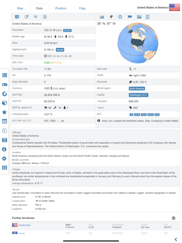
• Country data: More info about languages and international organisations
8.6.x:
• New choropleth map: population density
• Country comparison and World Explorer new key indicator: population density
8.3.x:
• Print maps and country data
• Country comparison and World Explorer new key indicator: Gini coefficient
• Historical political world & continent maps of 1930
• Search for islands and island groups
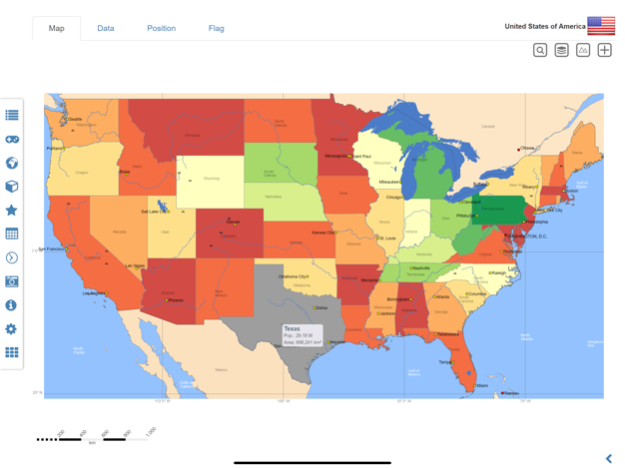
• Search for principal subdivisions like states or provinces
6.8.x:
• Search for countries, major cities, rivers, mountains, lakes and coordinates
• World Explorer: largest cities, longest rivers and highest mountains
• Quiz: the longest rivers on Earth
6.2.x:
• Quiz: Federal states for selected countries
• Country info: government type, climate and date of independence
• Distance calculator: more cities
5.x:
• Administrative subdivision maps for selected countries
• Historical political world & continent maps of 1900 & 1960
version 9.1.2
posted on 2024-01-12
Jan 12, 2024
Version 9.1.2
• Updates and corrections for maps and data
• Bug fixes and improvements
• Improved river search in map view
• Enhanced chart visualization
version 8.9.9
posted on 2023-09-15
Sep 15, 2023
Version 8.9.9
• Updates and corrections for maps and data
• Improved river search in map view
• Bug fixes and improvements
version 8.9.7
posted on 2023-07-18
Jul 18, 2023
Version 8.9.7
• Updates and corrections for maps and data
• Improved quiz questions choice
• Enhanced chart visualization
• Country data: More info about languages and international organisations
• Bug fixes and improvements
8.6.x:
• New choropleth map: population density
• Country comparison and World Explorer new key indicator: population density
8.3.x:
• Print maps and country data
• Country comparison and World Explorer new key indicator: Gini coefficient
• Historical political world & continent maps of 1930
• Search for islands and island groups
• Search for principal subdivisions like states or provinces
6.8.x:
• Search for countries, major cities, rivers, mountains, lakes and coordinates
• World Explorer: largest cities, longest rivers and highest mountains
• Quiz: the longest rivers on Earth
6.2.x:
• Quiz: Federal states for selected countries
• Country info: government type, climate and date of independence
• Distance calculator: more cities
5.x:
• Administrative subdivision maps for selected countries
• Historical political world & continent maps of 1900 & 1960
version 8.9.6
posted on 2023-06-25
Jun 25, 2023
Version 8.9.6
• Updates and corrections for maps and data
• Improved quiz questions choice
• Enhanced chart visualization
• Country data: More info about languages and international organisations
• Bug fixes and improvements
8.6.x:
• New choropleth map: population density
• Country comparison and World Explorer new key indicator: population density
8.3.x:
• Print maps and country data
• Country comparison and World Explorer new key indicator: Gini coefficient
• Historical political world & continent maps of 1930
• Search for islands and island groups
• Search for principal subdivisions like states or provinces
6.8.x:
• Search for countries, major cities, rivers, mountains, lakes and coordinates
• World Explorer: largest cities, longest rivers and highest mountains
• Quiz: the longest rivers on Earth
6.2.x:
• Quiz: Federal states for selected countries
• Country info: government type, climate and date of independence
• Distance calculator: more cities
5.x:
• Administrative subdivision maps for selected countries
• Historical political world & continent maps of 1900 & 1960
version 8.9.3
posted on 2023-04-19
Apr 19, 2023
Version 8.9.3
• Updates and corrections for maps and data
• Improved quiz questions choice
• Enhanced chart visualization
• Country data: More info about languages and international organisations
• Bug fixes and improvements
8.7.x:
• Updates for Human Development Index (HDI) data
• Updates for economic data (GDP, GDP PC,)
8.6.x:
• New choropleth map: population density
• Country comparison and World Explorer new key indicator: population density
8.3.x:
• Print maps and country data
• Country comparison and World Explorer new key indicator: Gini coefficient
• Historical political world & continent maps of 1930
• Search for islands and island groups
• Search for principal subdivisions like states or provinces
6.8.x:
• Search for countries, major cities, rivers, mountains, lakes and coordinates
• World Explorer: largest cities, longest rivers and highest mountains
• Quiz: the longest rivers on Earth
6.2.x:
• Quiz: Federal states for selected countries
• Country info: government type, climate and date of independence
• Distance calculator: more cities
5.x:
• Administrative subdivision maps for selected countries
• Historical political world & continent maps of 1900 & 1960
version 8.7.9
posted on 2023-01-31
Jan 31, 2023
Version 8.7.9
• Updates and corrections for maps and data
• Bug fixes and improvements
8.7.x:
• Updates for Human Development Index (HDI) data
• Updates for economic data (GDP, GDP PC,)
8.6.x:
• New choropleth map: population density
• Country comparison and World Explorer new key indicator: population density
8.3.x:
• Print maps and country data
• Country comparison and World Explorer new key indicator: Gini coefficient
• Historical political world & continent maps of 1930
• Search for islands and island groups
• Search for principal subdivisions like states or provinces
6.8.x:
• Search for countries, major cities, rivers, mountains, lakes and coordinates
• World Explorer: largest cities, longest rivers and highest mountains
• Quiz: the longest rivers on Earth
6.2.x:
• Quiz: Federal states for selected countries
• Country info: government type, climate and date of independence
• Distance calculator: more cities
5.x:
• Administrative subdivision maps for selected countries
• Historical political world & continent maps of 1900 & 1960
version 8.6.4
posted on 2022-06-27
Jun 27, 2022 Version 8.6.4
• Updates and corrections for maps and data
• New choropleth map: population density
• Country comparison and World Explorer new key indicator: population density
8.3.x:
• Print maps and country data
• Country comparison and World Explorer new key indicator: Gini coefficient
• New: Historical political world & continent maps of 1930 added
• Search for islands and island groups
• Search for principal subdivisions like states or provinces
6.8.x:
• Search for countries, major cities, rivers, mountains, lakes and coordinates
• World Explorer: largest cities, longest rivers and highest mountains
• New Quiz: Do you know the longest rivers on Earth?
6.2.x:
• Quiz: Federal states for selected countries
• Country info: government type, climate and date of independence
• Distance calculator: more cities
• Dynamic scale bars
5.x:
• Administrative subdivision maps for selected countries
• Historical political world & continent maps of 1900 & 1960
version 8.5.0
posted on 2022-03-10
Mar 10, 2022 Version 8.5.0
• Updates and corrections for maps and data
• Bug fixes and improvements
• Printing of maps and country data
• Country comparison and World Explorer new key indicator: Gini coefficient
8.3.x:
• New: Historical political world & continent maps of 1930 added
• Search for islands and island groups
• Search for principal subdivisions like states or provinces
6.8.x:
• Search for countries, major cities, rivers, mountains, lakes and coordinates
• World Explorer: largest cities, longest rivers and highest mountains
• New Quiz: Do you know the longest rivers on Earth?
6.2.x:
• Quiz: Federal states for selected countries
• Country info: government type, climate and date of independence
• Distance calculator: more cities
• Dynamic scale bars
5.x:
• Administrative subdivision maps for selected countries
• Historical political world & continent maps of 1900 & 1960
version 8.4.9
posted on 2022-02-19
Feb 19, 2022
Version 8.4.9
• Updates and corrections for maps and data
• Printing of maps and country data
• Bug fixes and improvements
• Country comparison and World Explorer new key indicator: Gini coefficient
8.3.x:
• New: Historical political world & continent maps of 1930 added
• Search for islands and island groups
• Search for principal subdivisions like states or provinces
6.8.x:
• Search for countries, major cities, rivers, mountains, lakes and coordinates
• World Explorer: largest cities, longest rivers and highest mountains
• New Quiz: Do you know the longest rivers on Earth?
6.2.x:
• Quiz: Federal states for selected countries
• Country info: government type, climate and date of independence
• Distance calculator: more cities
• Dynamic scale bars
5.x:
• Administrative subdivision maps for selected countries
• Historical political world & continent maps of 1900 & 1960
version 8.4.0
posted on 2022-01-25
Jan 25, 2022 Version 8.4.0
• Corrections and updates for maps and data
• Bug fixes and improvements
• Country comparison and World Explorer new key indicator: Gini coefficient
8.3.x:
• New: Historical political world & continent maps of 1930 added
• Search for islands and island groups
• Search for principal subdivisions like states or provinces
6.8.x:
• Search for countries, major cities, rivers, mountains, lakes and coordinates
• World Explorer: largest cities, longest rivers and highest mountains
• New Quiz: Do you know the longest rivers on Earth?
6.2.x:
• Quiz: Federal states for selected countries
• Country info: government type, climate and date of independence
• Distance calculator: more cities
• Dynamic scale bars
5.x:
• Administrative subdivision maps for selected countries
• Historical political world & continent maps of 1900 & 1960
version 8.3.1
posted on 2021-10-28
Oct 28, 2021 Version 8.3.1
• New: Historical maps of 1930 added
• Corrections and updates for maps and data
• Search for principal subdivisions like states or provinces
• Search for islands and island groups
• Bug fixes and improvements
6.8.x:
• Search for countries, major cities, rivers, mountains, lakes and coordinates
• World Explorer: largest cities, longest rivers and highest mountains
• Additional political map layer
• New Quiz: Do you know the longest rivers on Earth?
6.2.x:
• Quiz: Federal states for selected countries
• Country info: government type, climate and date of independence
• Distance calculator: more cities
• Dynamic scale bars
5.x:
• Administrative subdivision maps for selected countries
• Historical political world & continent maps of 1900 & 1960
version 8.2.9
posted on 2021-09-13
Sep 13, 2021 Version 8.2.9
• Search for principal subdivisions like states or provinces
• Search for islands and island groups
• Easily switch between political and relief map layer
• Corrections and updates for maps and data
• Bug fixes and improvements
6.8.x:
• Search for countries, major cities, rivers, mountains, lakes and coordinates
• World Explorer: largest cities, longest rivers and highest mountains
• Additional political map layer
• New Quiz: Do you know the longest rivers on Earth?
6.2.x:
• Quiz: Federal states for selected countries
• Country info: government type, climate and date of independence
• Distance calculator: more cities
• Dynamic scale bars
5.x:
• Administrative subdivision maps for selected countries
• Historical political world & continent maps of 1900 & 1960
version 8.2.8
posted on 2021-08-15
Aug 15, 2021 Version 8.2.8
• Search for principal subdivisions like states or provinces
• Search for islands and island groups
• Easily switch between political and relief map layer
• Corrections and updates for maps and data
• Bug fixes and improvements
6.8.x:
• Search for countries, major cities, rivers, mountains, lakes and coordinates
• World Explorer: largest cities, longest rivers and highest mountains
• Additional political map layer
• New Quiz: Do you know the longest rivers on Earth?
6.2.x:
• Quiz: Federal states for selected countries
• Country info: government type, climate and date of independence
• Distance calculator: more cities
• Dynamic scale bars
5.x:
• Administrative subdivision maps for selected countries
• Historical political world & continent maps of 1900 & 1960
version 8.2.4
posted on 2021-06-29
Jun 29, 2021 Version 8.2.4
• Search for principal subdivisions like states or provinces
• Search for islands and island groups
• Easily switch between political and relief map layer
• Corrections and updates for maps and data
• Bug fixes and improvements
6.8.x:
• Search for countries, major cities, rivers, mountains, lakes and coordinates
• World Explorer: largest cities, longest rivers and highest mountains
• Additional political map layer
• New Quiz: Do you know the longest rivers on Earth?
6.2.x:
• Quiz: Federal states for selected countries
• Country info: government type, climate and date of independence
• Distance calculator: more cities
• Dynamic scale bars
5.x:
• Administrative subdivision maps for selected countries
• Historical political world & continent maps of 1900 & 1960
version 6.8.16
posted on 2021-01-19
Jan 19, 2021 Version 6.8.16
• New Quiz: Do you know the longest rivers on Earth?
• Updates for maps and data: HDI 2020, ...
• Search for countries, major cities, rivers, deserts, lakes, mountains or coordinates
• World Explorer: largest cities, longest rivers and highest mountains
6.2.x:
• New Quiz: Federal states for selected countries
• Country data now with info about government type, climate and date of independence
• Distance calculator: more cities
5.x:
• Administrative area maps for selected countries
• Top cities by population for each country and continent
• Historical political world & continent maps of 1900 & 1960
version 6.8.15
posted on 2021-01-18
Jan 18, 2021 Version 6.8.15
• New Quiz: Do you know the longest rivers on Earth?
• Updates for maps and data: HDI 2020, ...
• Search for countries, major cities, rivers, deserts, lakes, mountains or coordinates
• World Explorer: largest cities, longest rivers and highest mountains
6.2.x:
• New Quiz: Federal states for selected countries
• Country data now with info about government type, climate and date of independence
• Distance calculator: more cities
5.x:
• Administrative area maps for selected countries
• Top cities by population for each country and continent
• Historical political world & continent maps of 1900 & 1960
version 6.8.12
posted on 2020-10-25
25 Oct 2020 Version 6.8.12
• Search for countries, major cities, rivers, mountains, lakes or coordinates
• World Explorer: largest cities, rivers and highest mountains
• Additional political map layer
• Corrections & updates for maps and data
• Bug fixes
6.2.x:
• Quiz: Federal states for selected countries
• Country data: government type, climate and date of independence
• Distance calculator: more cities
5.x:
• Administrative area maps for selected countries
• Historical political world & continent maps of 1900 & 1960
version 6.8.12
posted on 2020-10-25
Oct 25, 2020 Version 6.8.12
• Search for countries, major cities, rivers, mountains, lakes or coordinates
• World Explorer: largest cities, rivers and highest mountains
• Additional political map layer
• Corrections & updates for maps and data
• Bug fixes
6.2.x:
• Quiz: Federal states for selected countries
• Country data: government type, climate and date of independence
• Distance calculator: more cities
5.x:
• Administrative area maps for selected countries
• Historical political world & continent maps of 1900 & 1960
version 6.8.10
posted on 2020-09-24
Sep 24, 2020 Version 6.8.10
• Search for countries, major cities, rivers, mountains, lakes or coordinates
• World Explorer: largest cities, longest rivers and highest mountains
• Additional political map layer
• Corrections and updates for maps and data
• Bug fixes and improvements
6.2.x:
• New Quiz: Federal states for selected countries
• Dynamic scale bar
• Country data now with info about government type, climate and date of independence
• Distance calculator: more cities
5.x:
• Administrative area maps for selected countries
• Historical political world & continent maps of 1900 & 1960
version 6.8.5
posted on 2020-07-05
Jul 5, 2020 Version 6.8.5
• Search for countries, major cities, rivers & mountains or coordinates
• Additional political map layer
• HDI data Update
• Corrections & updates for maps and data
• Bug fixes & improvements
6.2.x:
• New Quiz: Federal states for selected countries
• Dynamic scale bar
• Country data now with about government type, climate and date of independence
• Distance calculator: more cities
5.x:
• Administrative area maps for selected countries
• Top cities by population for each country and continent
• Historical political world & continent maps of 1900 & 1960
version 6.5.6
posted on 2020-05-25
May 25, 2020 Version 6.5.6
• Country search now supports alternative names
• Bug fixes and improvements
• HDI 2019
• Corrections and updates for maps and data
• Bug fixes & improvements
6.2.x:
• Dynamic scale bar
• Country data now including info about government type, climate and date of independence
• Distance calculator: more cities
• Virtual World Tour
5.x:
• Temperature data: Centigrade or Fahrenheit
• Country data and time zones update
• New key figure HDI in World Explorer
version 6.5.0
posted on 2020-04-27
Apr 27, 2020 Version 6.5.0
• Additional political map layer
• Update Human Development Index 2019
• Bug fixes and improvements
• Corrections and updates for maps and data
6.2.x:
• Federal states / provinces for selected countries
• Additional map type for world and continents maps
• Dynamic scale bar
• Country data now including info about government type, climate and date of independence
• Distance calculator: more cities
• Virtual World Tour
5.x:
• Historical political world and continent maps of 1900 and 1960
• Administrative area maps for selected countries
• Top cities by population for each country and continent
version 6.2.92
posted on 2020-02-20
Feb 20, 2020 Version 6.2.92
• New quiz: federal states / provinces for selected countries
• Bug fixes and improvements
• Corrections and updates for maps and data
6.x:
• New: additional map type for world and continents maps
• New: dynamic scale bar
• New: country data now including info about government type, climate and date of independence
• Distance calculator: more cities
• Virtual World Tour
5.x:
• Historical political world and continent maps of 1900 and 1960
• Administrative area maps for selected countries
• Top cities by population for each country and continent
version 4.3
posted on 2016-07-13
version 6.8.16
posted on 1970-01-01
19 gen 2021 Version 6.8.16
• New Quiz: Do you know the longest rivers on Earth?
• Updates for maps and data: HDI 2020, ...
• Search for countries, major cities, rivers, deserts, lakes, mountains or coordinates
• World Explorer: largest cities, longest rivers and highest mountains
6.2.x:
• New Quiz: Federal states for selected countries
• Country data now with info about government type, climate and date of independence
• Distance calculator: more cities
5.x:
• Administrative area maps for selected countries
• Top cities by population for each country and continent
• Historical political world & continent maps of 1900 & 1960
version 6.2.92
posted on 1970-01-01
2020年2月20日 Version 6.2.92
• New quiz: federal states / provinces for selected countries
• Bug fixes and improvements
• Corrections and updates for maps and data
6.x:
• New: additional map type for world and continents maps
• New: dynamic scale bar
• New: country data now including info about government type, climate and date of independence
• Distance calculator: more cities
• Virtual World Tour
5.x:
• Historical political world and continent maps of 1900 and 1960
• Administrative area maps for selected countries
• Top cities by population for each country and continent
version 6.8.5
posted on 1970-01-01
5 июля 2020 г. Version 6.8.5
• Search for countries, major cities, rivers & mountains or coordinates
• Additional political map layer
• HDI data Update
• Corrections & updates for maps and data
• Bug fixes & improvements
6.2.x:
• New Quiz: Federal states for selected countries
• Dynamic scale bar
• Country data now with about government type, climate and date of independence
• Distance calculator: more cities
5.x:
• Administrative area maps for selected countries
• Top cities by population for each country and continent
• Historical political world & continent maps of 1900 & 1960